Know what sits on and around the site before scoping starts
Import the boundary, run the scan, and get a constraints register in which every designation and receptor carries its distance from the site and the zone of influence it is assessed against.
What changes
Site & constraints, before and after
Without it
- Waiting on GIS for a constraints plan
- Distances measured by hand into a spreadsheet
- A different buffer for every topic, written down nowhere
With EcoSphere Intelligence
- Boundary imported from a Shapefile, GeoPackage, KML or GeoJSON
- Every constraint listed with its distance from the boundary
- Each zone of influence shown with where it came from
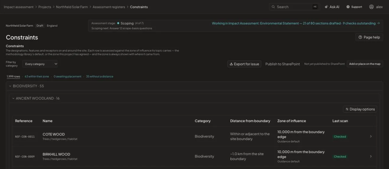
1,999 constraints registered on one pilot project, 63 of them inside their zone of influence.
One scan, every relevant layer
The scan checks the boundary against designation and receptor layers maintained in the platform: European and national nature sites, ancient woodland and heritage assets among them. Where a layer is not complete nationally, the platform says so instead of implying the site is clear.
A register, not just a map
Every constraint becomes a row in the constraints register with a reference, category, distance band and zone of influence. The zone comes from the methodology library or from the distance your project has agreed, and the register shows which.
- Grouped by topic and designation type
- Export for issue or publish to SharePoint
- Re-scan when the boundary changes
How it works
From start to issue in four steps
- 1
Import the boundary
Upload the red line as a Shapefile, GeoPackage, KML or GeoJSON, or draw and edit it on the map.
- 2
Run the scan
The site is checked against every relevant designation and receptor layer.
- 3
Review the register
Confirm zones of influence, add local constraints and place anything missing.
- 4
Issue the figure
Generate a site-constraints figure and export the register for the report.
See it on one of your projects
Book a 45-minute walkthrough. Bring a live or recent assessment and we will show you how it would run in EcoSphere Intelligence.